
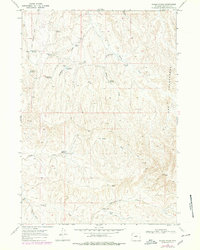
1966 Map of Wagon Prong
USGS Topo · Published 1972About this map
Nowater Creek and the ephemeral drainage of Wagon Prong define this arid landscape in Washakie County, Wyoming. The territory is marked by the presence of livestock operations and vital water management infrastructure, evidenced by numerous named stock ponds and catchment areas such as Nugget Res, Hampton Well No 2, and Hayes Well. Distinctive topographic features like the Honeycombs and Devils Slide break the horizon, while seasonal camps such as Meleskie Camp and Hayes Cow Camp speak to the region's ranching heritage. The presence of an Old Quaker Reservoir suggests historical settlement efforts or specific land use patterns from an earlier era. Surface activity is further mapped through a network of tracks, including a Jeep Trail, and specific points of interest like a Drill Hole and The Seeps.
Find a feature on this map
40 named features on this map. Tap any name to fly to it.
Don’t see what you’re looking for? This feature index may not catch every label — zoom into the map to look around manually.
Map Details
Editions of this 1966 Wagon Prong Map
2 editions found
Other maps of this area

1955 · Arminto
USGS Topo · 1:250,000

1958 · Arminto
USGS Topo · 1:250,000

1960 · Packsaddle Creek
USGS Topo · 1:24,000

1962 · Arminto
USGS Topo · 1:250,000

1966 · Deadline Draw
USGS Topo · 1:24,000

1966 · Sand Point
USGS Topo · 1:24,000

1966 · Cabin Fork
USGS Topo · 1:24,000

1966 · Bader Draw
USGS Topo · 1:24,000
1966 · Henry Draw
USGS Topo · 1:24,000
1966 · Banjo Flats East
USGS Topo · 1:24,000