
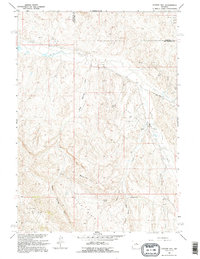
1960 Map of Coyote Hill
USGS Topo · Published 1962About this map
The industrial infrastructure of the Kirby Creek Oil Field dominates this 1960s landscape, illustrating the mid-century energy development in Hot Springs and Washakie counties. A network of pipelines, oil wells, and pumping stations weaves through the dissected terrain, centered around Kirby Creek and the primary thoroughfare of Black Mountain Road. The map provides a detailed view of the regional hydrology, defined by ephemeral features such as Blue Springs Draw, Alkali Creek, and the prominent Major Basin. High points like Murphy Dome and Monument Hill rise above the drainage systems, while isolated water sources like Malcolm Spring and Brantley Spring offer specific landmarks for those tracing the historical geography of this Wyoming range.
Find a feature on this map
23 named features on this map. Tap any name to fly to it.
Don’t see what you’re looking for? This feature index may not catch every label — zoom into the map to look around manually.
Map Details
Editions of this 1960 Coyote Hill Map
2 editions found
Other maps of this area

1945 · Kirby
USGS Topo · 1:62,500

1946 · Kirby
USGS Topo · 1:62,500

1952 · Rathbun Ranch
USGS Topo · 1:24,000

1955 · Thermopolis
USGS Topo · 1:250,000

1955 · Arminto
USGS Topo · 1:250,000

1957 · Rathbun Ranch
USGS Topo · 1:24,000

1958 · Thermopolis
USGS Topo · 1:250,000

1958 · Arminto
USGS Topo · 1:250,000

1960 · Devil Slide
USGS Topo · 1:24,000
1960 · Blue Hill
USGS Topo · 1:24,000