
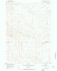
1951 Map of Schuster Flats NE
USGS Topo · Published 1952About this map
The boundary between Big Horn and Washakie Counties divides this drainage basin, recorded during the post-war expansion of the Missouri River Basin project. The landscape is defined by a dense network of watercourses, including the prominent Dobie Creek, Alamo Creek, and the various forks of Tenmile Creek. This 1951 field check reveals an area primarily focused on resource extraction, punctuated by several Oil Well sites and unimproved trails that navigate the undulating terrain south of Dobie Butte. The distribution of these wells alongside unnamed tracks suggests an active period of petroleum exploration in this segment of the Bighorn Basin, providing a specific record of early 1950s energy infrastructure in Wyoming.
Find a feature on this map
10 named features on this map. Tap any name to fly to it.
Don’t see what you’re looking for? This feature index may not catch every label — zoom into the map to look around manually.
Map Details
Editions of this 1951 Schuster Flats NE Map
3 editions found
Other maps of this area

1951 · Schuster Flats
USGS Topo · 1:24,000

1951 · Schuster Flats NW
USGS Topo · 1:24,000

1951 · Schuster Flats SE
USGS Topo · 1:24,000

1955 · Cody
USGS Topo · 1:250,000

1955 · Sheridan
USGS Topo · 1:250,000

1958 · Cody
USGS Topo · 1:250,000

1958 · Sheridan
USGS Topo · 1:250,000

1960 · Manderson
USGS Topo · 1:24,000

1962 · Sheridan
USGS Topo · 1:250,000

1962 · Cody
USGS Topo · 1:250,000