
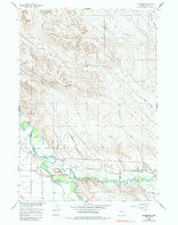
1960 Map of Manderson
USGS Topo · Published 1962About this map
Manderson sits at the confluence where the Nowood River meets the Big Horn River, serving as a critical junction for water, rail, and energy in Big Horn County. During the early 1960s, this landscape was defined by its industrial dualities, from the agricultural reliance on the Big Horn Canal and Harmony Ditch to the intensive energy extraction at the Manderson Field. The arrival of the Chicago Burlington and Quincy railroad supported both sectors, connecting local production to wider markets.
Find a feature on this map
23 named features on this map. Tap any name to fly to it.
Don’t see what you’re looking for? This feature index may not catch every label — zoom into the map to look around manually.
Map Details
Editions of this 1960 Manderson Map
2 editions found
Other maps of this area

1951 · Schuster Flats NE
USGS Topo · 1:24,000

1955 · Cody
USGS Topo · 1:250,000

1955 · Sheridan
USGS Topo · 1:250,000

1958 · Cody
USGS Topo · 1:250,000

1958 · Sheridan
USGS Topo · 1:250,000

1960 · Manderson NE
USGS Topo · 1:24,000

1960 · Manderson SE
USGS Topo · 1:24,000

1960 · Wild Horse Flats
USGS Topo · 1:24,000

1962 · Sheridan
USGS Topo · 1:250,000

1962 · Cody
USGS Topo · 1:250,000