2024 Map of Adams Run
USGS Topo · Published 2024About this map
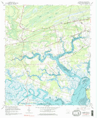
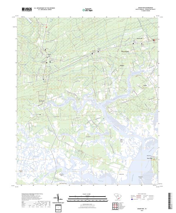
The Dawho River and Intracoastal Waterway wind through a complex system of islands and tidal creeks in this coastal region of South Carolina. The landscape is defined by its transition from the agricultural and timbered upland settlements of Adams Run and Hollywood to the sprawling marshes protected by the Ernest F Hollings Ace Basin National Wildlife Refuge. Numerous island landforms such as Jehossee Island, Slann Island, and Whooping Island characterize the lower portion of the map where the Wadmalaw River meets the sound.
Find a feature on this map
113 named features on this map. Tap any name to fly to it.
Don’t see what you’re looking for? This feature index may not catch every label — zoom into the map to look around manually.
Map Details
Editions of this 2024 Adams Run Map
This is the sole edition of this map. No revisions or reprints were ever made.