Loading...
Loading map...2023 Map of Addison
USGS Topo · Published 2023About this map
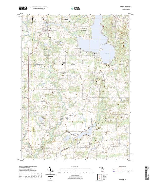
Addison sits at the northern edge of this Lenawee County landscape, situated near the headwaters of Bean Creek and the Addison Millpond. The geography is defined by a dense network of glacial lakes and drainage systems, most notably the large expanse of Devils Lake and its neighboring Round Lake. These water bodies are flanked by established summer colonies and residential clusters like Manitou Beach and Geneva, which contrast with the agricultural character of the southern townships.
Find a feature on this map
158 named features on this map. Tap any name to fly to it.
Don’t see what you’re looking for? This feature index may not catch every label — zoom into the map to look around manually.
Map Details
Date Portrayed2023
Date Published2023
PublisherU.S. Geological Survey
Map TypeTopographic
Scale1:24000
Physical Dimensions24 x 29 inches
Editions of this 2023 Addison Map
This is the sole edition of this map. No revisions or reprints were ever made.
Historical Maps of Hudson Township Through Time

Featured Locations
Source Details
SourceU.S. Geological Survey
CopyrightPublic Domain