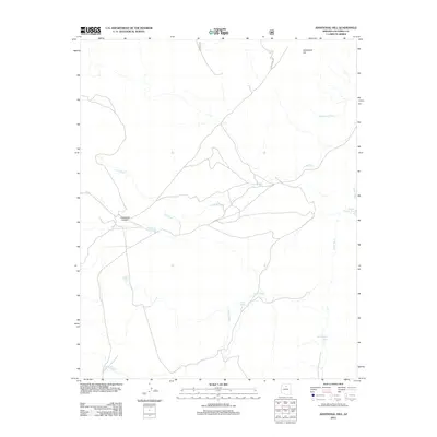
2012 Map of Additional Hill
USGS Topo · Published 2012About this map
Additional Hill rises above a landscape defined by an intricate network of ephemeral watercourses and vital catchment basins in this part of Coconino County. The drainage patterns are dominated by Lava Wash, Cedar Wash, and Needmore Wash, which carve through the high desert terrain. Human activity is evidenced primarily by a series of named stock tanks and water improvements, such as Eugene Gordy Tank, Michelbach Tank, and Mesa Butte Tank, indicating the area's continued use for ranching and livestock management.
Find a feature on this map
14 named features on this map. Tap any name to fly to it.
Don’t see what you’re looking for? This feature index may not catch every label — zoom into the map to look around manually.
Map Details
Editions of this 2012 Additional Hill Map
This is the sole edition of this map. No revisions or reprints were ever made.
Other maps of this area

1886 · San Francisco Mtns
USGS Topo · 1:250,000

1891 · San Francisco Mtns
USGS Topo · 1:250,000

1894 · San Francisco Mtns
USGS Topo · 1:250,000

1899 · San Francisco Mtns
USGS Topo · 1:250,000

1947 · Flagstaff
USGS Topo · 1:250,000

1954 · Flagstaff
USGS Topo · 1:250,000

1955 · Coconino Pt SE
USGS Topo · 1:24,000

1958 · Flagstaff
USGS Topo · 1:250,000

1960 · Flagstaff
USGS Topo · 1:250,000
1960 · Ebert Mtn
USGS Topo · 1:62,500