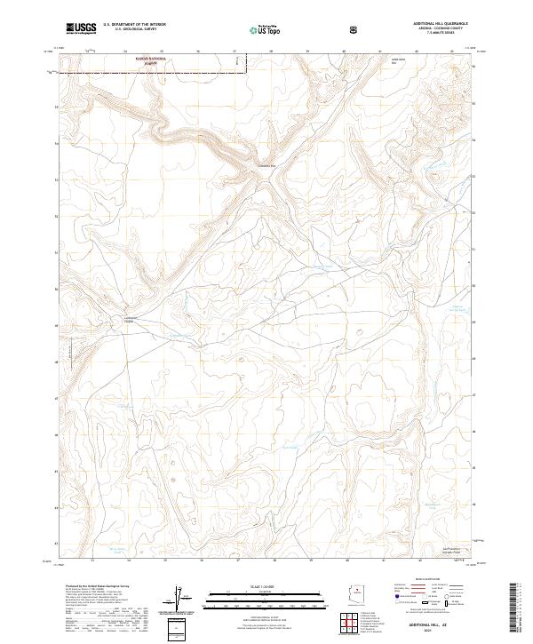
2021 Map of Additional Hill
USGS Topo · Published 2021About this map
Coconino Rim cuts through this high-desert landscape in northern Arizona, marking a significant topographic break within the Kaibab National Forest. The region is defined by its arid drainage systems, including the seasonally active Needmore Wash, Lava Wash, and Cedar Wash. This survey documents a remote section of the San Francisco Volcanic Field, where the reliance on scattered water catchments is evident through numerous named sites such as Malpais Tank, Michelbach Tank, and Eugene Gordy Tank. These tanks and the presence of BLM RD 6191 indicate a landscape primarily used for ranching and resource management. The map also includes the northern descent of Lockwood Canyon and the prominent height of Additional Hill in the northeast, providing a clear record of the intersection between forest boundaries and geological formations.
Find a feature on this map
20 named features on this map. Tap any name to fly to it.
Don’t see what you’re looking for? This feature index may not catch every label — zoom into the map to look around manually.
Map Details
Editions of this 2021 Additional Hill Map
This is the sole edition of this map. No revisions or reprints were ever made.
Other maps of this area

1886 · San Francisco Mtns
USGS Topo · 1:250,000

1891 · San Francisco Mtns
USGS Topo · 1:250,000

1894 · San Francisco Mtns
USGS Topo · 1:250,000

1899 · San Francisco Mtns
USGS Topo · 1:250,000

1947 · Flagstaff
USGS Topo · 1:250,000

1954 · Flagstaff
USGS Topo · 1:250,000

1955 · Coconino Pt SE
USGS Topo · 1:24,000

1958 · Flagstaff
USGS Topo · 1:250,000

1960 · Flagstaff
USGS Topo · 1:250,000
1960 · Ebert Mtn
USGS Topo · 1:62,500