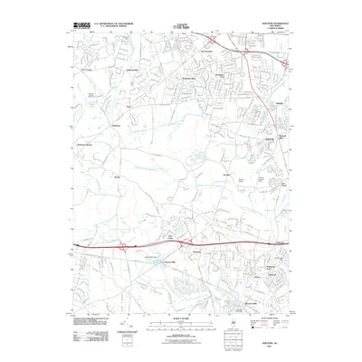
2011 Map of Adelphia
USGS Topo · Published 2011About this map
Oakland Mills and West Freehold sit at the northern edge of this coastal plain landscape, where the headwaters of several major New Jersey drainage systems begin their descent. The area is defined by the branching tributaries of the Manalapan Brook, the Manasquan River, and both branches of the Metedeconk River. These waterways historically powered local industry, evidenced by the concentration of mill sites such as Wyckoff Mills, Jacksons Mills, and Bennetts Mills. While suburban development like Stonehurst East and Stonehurst West has expanded, large agricultural and recreational tracts remain, including the Crest Fruit Farm and the Charleston Springs Golf Course. Small aviation strips like Ekdahl Airport and the Cuddihy Landing Strip are tucked between the wooded corridors of the North Branch Metedeconk River and South Branch Metedeconk River, reflecting the mix of rural utility and modern residential growth in Monmouth and Ocean Counties.
Find a feature on this map
50 named features on this map. Tap any name to fly to it.
Don’t see what you’re looking for? This feature index may not catch every label — zoom into the map to look around manually.
Map Details
Editions of this 2011 Adelphia Map
This is the sole edition of this map. No revisions or reprints were ever made.
Other maps of this area

1888 · New Brunswick
USGS Topo · 1:62,500

1888 · Asbury Park
USGS Topo · 1:62,500

1888 · Cassville
USGS Topo · 1:62,500

1888 · Sandy Hook
USGS Topo · 1:62,500

1893 · New Brunswick
USGS Topo · 1:62,500

1893 · Sandy Hook
USGS Topo · 1:62,500

1893 · Asbury Park
USGS Topo · 1:62,500

1894 · Cassville
USGS Topo · 1:62,500

1900 · Cassville
USGS Topo · 1:62,500

1901 · New Brunswick
USGS Topo · 1:62,500