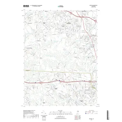
2019 Map of Adelphia
USGS Topo · Published 2019About this map
Adelphia and the surrounding township appear as a dense network of residential developments and historic crossroads at the edge of the Pine Barrens. The landscape is defined by its industrial roots along the numerous watercourses, where settlements like Wyckoff Mills, Jacksons Mills, and Bennetts Mills grew around early water power sites. Further north, the suburban expansion of West Freehold and Stonehurst East contrasts with the smaller, isolated settlements of Siloam and Georgia that maintain a more rural character. The map illustrates a complex drainage system where the Manasquan River and the N Br Metedeconk River originate, carving through the terrain alongside landmarks like the Cuddihy Landing Strip. This 2019 survey documents the modern intersection of historic mill towns and the continuing growth of central New Jersey neighborhoods.
Find a feature on this map
48 named features on this map. Tap any name to fly to it.
Don’t see what you’re looking for? This feature index may not catch every label — zoom into the map to look around manually.
Map Details
Editions of this 2019 Adelphia Map
This is the sole edition of this map. No revisions or reprints were ever made.
Other maps of this area

1888 · New Brunswick
USGS Topo · 1:62,500

1888 · Asbury Park
USGS Topo · 1:62,500

1888 · Cassville
USGS Topo · 1:62,500

1888 · Sandy Hook
USGS Topo · 1:62,500

1893 · New Brunswick
USGS Topo · 1:62,500

1893 · Sandy Hook
USGS Topo · 1:62,500

1893 · Asbury Park
USGS Topo · 1:62,500

1894 · Cassville
USGS Topo · 1:62,500

1900 · Cassville
USGS Topo · 1:62,500

1901 · New Brunswick
USGS Topo · 1:62,500