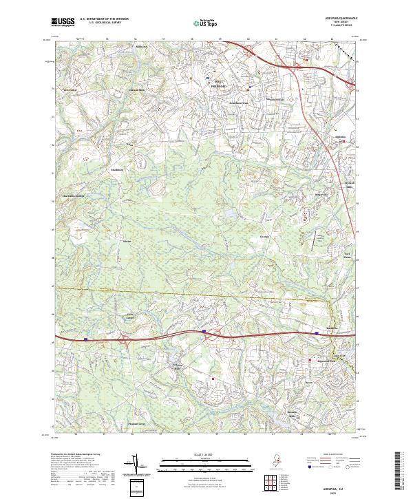
2023 Map of Adelphia
USGS Topo · Published 2023About this map
The Manasquan River and the headwaters of the North Branch Metedeconk River define the hydrography of this Monmouth and Ocean County borderland. Several historic milling sites, including Millhurst, Oakland Mills, and Wyckoff Mills, reflect the area's agricultural and industrial heritage. While residential growth is evident in suburban developments like Stonehurst East and Stonehurst West, older crossroad communities such as Georgia, Siloam, and Adelphia maintain their distinct geographic identities. The map also identifies local aviation history with the Cuddihy Landing Strip situated east of Georgia. Moving south toward the county line, the landscape transitions into the Metedeconk watershed, where Jacksons Mills Lake and Bennetts Pond provide significant water features near the growing settlements of Jacksons Mills and Bennetts Mills.
Find a feature on this map
47 named features on this map. Tap any name to fly to it.
Don’t see what you’re looking for? This feature index may not catch every label — zoom into the map to look around manually.
Map Details
Editions of this 2023 Adelphia Map
This is the sole edition of this map. No revisions or reprints were ever made.
Other maps of this area

1888 · New Brunswick
USGS Topo · 1:62,500

1888 · Asbury Park
USGS Topo · 1:62,500

1888 · Cassville
USGS Topo · 1:62,500

1888 · Sandy Hook
USGS Topo · 1:62,500

1893 · New Brunswick
USGS Topo · 1:62,500

1893 · Sandy Hook
USGS Topo · 1:62,500

1893 · Asbury Park
USGS Topo · 1:62,500

1894 · Cassville
USGS Topo · 1:62,500

1900 · Cassville
USGS Topo · 1:62,500

1901 · New Brunswick
USGS Topo · 1:62,500