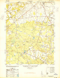
1947 Map of Adelphia
USGS Topo · Published 1947About this map
Cranberry bogs dominate the low-lying terrain of central New Jersey in this late 1940s landscape, illustrating a specialized agricultural economy concentrated between the Manasquan River and the headwaters of the North Branch Metedeconk River. The boundary between Monmouth County and Ocean County cuts across the southern half of the sheet, where small settlements like Harmony and Jacksons Mills are connected by a network of unimproved roads and light-duty routes.
Find a feature on this map
35 named features on this map. Tap any name to fly to it.
Don’t see what you’re looking for? This feature index may not catch every label — zoom into the map to look around manually.
Map Details
Editions of this 1947 Adelphia Map
2 editions found
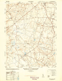
Other maps of this area

1888 · New Brunswick
USGS Topo · 1:62,500

1888 · Asbury Park
USGS Topo · 1:62,500

1888 · Cassville
USGS Topo · 1:62,500

1888 · Sandy Hook
USGS Topo · 1:62,500

1893 · New Brunswick
USGS Topo · 1:62,500

1893 · Sandy Hook
USGS Topo · 1:62,500

1893 · Asbury Park
USGS Topo · 1:62,500

1894 · Cassville
USGS Topo · 1:62,500

1900 · Cassville
USGS Topo · 1:62,500

1901 · New Brunswick
USGS Topo · 1:62,500