2021 Map of Adrian
USGS Topo · Published 2021About this map
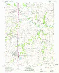
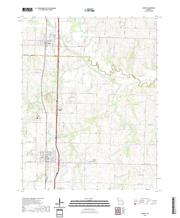
South Grand River meanders across the border of Cass and Bates counties, defining the agricultural landscape between the growing communities of Archie and Adrian. This rural corridor is anchored by the historic settlement of Crescent Hill, where the Crescent Hill Cem serves as a significant landmark for local genealogists. The terrain is characterized by a network of drainage systems including Eightmile Creek, Mormon Fork, and the winding Big Deer Cr, which flow through a grid of section roads and established homesteads.
Find a feature on this map
98 named features on this map. Tap any name to fly to it.
Don’t see what you’re looking for? This feature index may not catch every label — zoom into the map to look around manually.
Map Details
Editions of this 2021 Adrian Map
This is the sole edition of this map. No revisions or reprints were ever made.