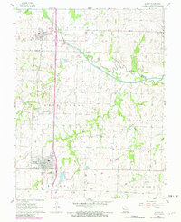
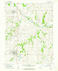
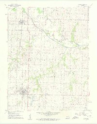
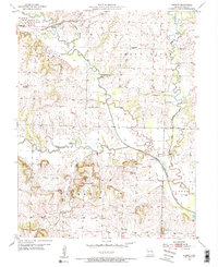
1961 Map of Adrian
USGS Topo · Published 1982About this map
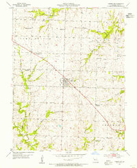
The Missouri Pacific railroad corridor anchors this survey of northern Bates County and southern Cass County, where the plains meet the winding tributaries of the Grand River. Between the established towns of Adrian and Archie, the landscape is defined by its watercourses, including the Old Channel and Mormon Fork. The map documents early community centers and rural life, featuring labels for the Coleville Community and the Fairview Sch. These small agrarian nodes, often located near local cemeteries like Austin Cem and Crescent Hill Cem, illustrate the distribution of early Missouri settlements before the consolidation of larger township hubs. To the south, the Adrian Reservoir and a Sew Disp Pond reflect the infrastructure needs of the growing town of Adrian as it expanded near the county line.
Find a feature on this map
25 named features on this map. Tap any name to fly to it.
Don’t see what you’re looking for? This feature index may not catch every label — zoom into the map to look around manually.
Map Details
Editions of this 1961 Adrian Map
3 editions found
Other maps of this area

1887 · Harrisonville
USGS Topo · 1:125,000

1887 · Butler
USGS Topo · 1:125,000

1892 · Harrisonville
USGS Topo · 1:125,000

1894 · Harrisonville
USGS Topo · 1:125,000

1894 · Butler
USGS Topo · 1:125,000

1947 · Lawrence
USGS Topo · 1:250,000

1950 · Lawrence
USGS Topo · 1:250,000
1953 · Everett
USGS Topo · 1:24,000
1954 · Garden City
USGS Topo · 1:24,000
1954 · Austin
USGS Topo · 1:24,000