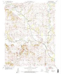
1953 Map of Everett
USGS Topo · Published 1955About this map
The South Fork Grand River meanders across the Missouri landscape of Cass County, defining the rural character of the Everett and Austin districts. This mid-century survey reveals a dense network of one-room schoolhouses, many of which were already being phased out, such as the Zion Sch (Abandoned) and Steen Sch (Abandoned). These small institutions, along with the Grand River Ch and various family-named burial grounds like Burford Cem, served as the social anchors for a farming community organized around the river's floodplains and the high ground of the surrounding hills.
Find a feature on this map
34 named features on this map. Tap any name to fly to it.
Don’t see what you’re looking for? This feature index may not catch every label — zoom into the map to look around manually.
Map Details
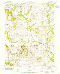
Editions of this 1953 Everett Map
2 editions found
Other maps of this area

1887 · Harrisonville
USGS Topo · 1:125,000

1887 · Olathe
USGS Topo · 1:125,000

1887 · Butler
USGS Topo · 1:125,000

1887 · Mound City
USGS Topo · 1:125,000

1892 · Harrisonville
USGS Topo · 1:125,000

1893 · Mound City
USGS Topo · 1:125,000

1893 · Olathe
USGS Topo · 1:125,000

1894 · Harrisonville
USGS Topo · 1:125,000

1894 · Butler
USGS Topo · 1:125,000

1947 · Lawrence
USGS Topo · 1:250,000