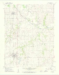
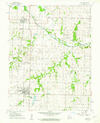
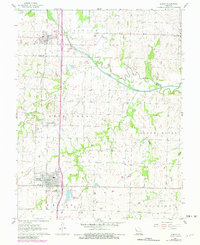
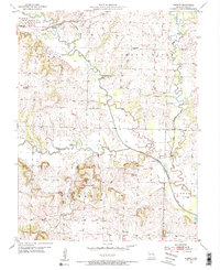
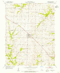
1961 Map of Adrian
USGS Topo · Published 1962About this map
The Missouri Pacific railroad corridor serves as the primary spine for this section of Missouri, connecting the northern settlement of Archie with Adrian to the south. The landscape is defined by the winding course of the South Grand River, where the presence of an Old Channel indicates the historical shifting of the river's path through the floodplains. This 1961 survey provides a clear view of the rural social infrastructure of the era, from the Coleville Community Hall to local landmarks like Fairview Sch and Crescent Hill Cem. The topography reveals a mix of creek-bottom lowlands and the higher ground of townships like Austin and Mound. Significant local developments such as the Adrian Reservoir and a nearby Sewage Disposal plant illustrate the mid-century expansion of municipal utilities into the surrounding countryside.
Find a feature on this map
27 named features on this map. Tap any name to fly to it.
Don’t see what you’re looking for? This feature index may not catch every label — zoom into the map to look around manually.
Map Details
Editions of this 1961 Adrian Map
3 editions found
Other maps of this area

1887 · Harrisonville
USGS Topo · 1:125,000

1887 · Butler
USGS Topo · 1:125,000

1892 · Harrisonville
USGS Topo · 1:125,000

1894 · Harrisonville
USGS Topo · 1:125,000

1894 · Butler
USGS Topo · 1:125,000

1947 · Lawrence
USGS Topo · 1:250,000

1950 · Lawrence
USGS Topo · 1:250,000
1953 · Everett
USGS Topo · 1:24,000
1954 · Garden City
USGS Topo · 1:24,000
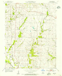
1954 · Austin
USGS Topo · 1:24,000