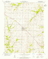
1954 Map of Garden City
USGS Topo · Published 1955About this map
Garden City serves as the central hub for this rural Cass County landscape, situated at a key intersection where a heavy-duty highway and a railway line cross the terrain. The map reveals a transition in rural education during the mid-1950s, marking several locations as defunct, such as Sugar Creek Sch and Wallace Sch, while others like Peach Grove Sch and Index Sch remained active. Small pockets of industry are visible in the northeast, including a Quarry, Gas Wells, and Oil Wells, providing a glimpse into the local extraction economy of the era.
Find a feature on this map
34 named features on this map. Tap any name to fly to it.
Don’t see what you’re looking for? This feature index may not catch every label — zoom into the map to look around manually.
Map Details
Editions of this 1954 Garden City Map
This is the sole edition of this map. No revisions or reprints were ever made.
Other maps of this area

1887 · Harrisonville
USGS Topo · 1:125,000

1887 · Butler
USGS Topo · 1:125,000

1892 · Harrisonville
USGS Topo · 1:125,000

1894 · Harrisonville
USGS Topo · 1:125,000

1894 · Butler
USGS Topo · 1:125,000

1947 · Lawrence
USGS Topo · 1:250,000

1950 · Lawrence
USGS Topo · 1:250,000
1953 · Creighton
USGS Topo · 1:24,000

1954 · Harrisonville
USGS Topo · 1:24,000
1954 · East Lynne
USGS Topo · 1:24,000