2023 Map of Adrian
USGS Topo · Published 2023About this map
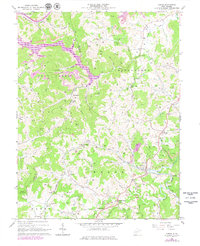
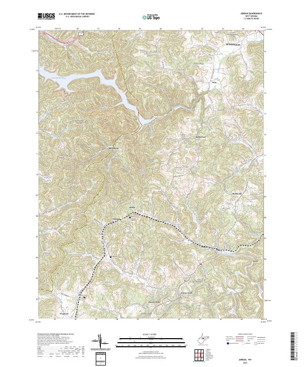
Stonecoal Reservoir dominates the northwestern reaches of this modern topographical survey, situated along the border of Lewis Co and Upshur Co. The terrain is defined by the elevation of Buckhannon Mountain and Mulberry Ridge, which separate a network of small settlements and rural crossroads. To the east, the Upshur County Regional Airport sits near the larger hub of Buckhannon, while smaller communities like Adrian, French Creek, and Hinkleville are scattered throughout the winding valleys. Researchers can identify several family and community burial sites, including Point Pleasant Cem near Abbott and Beechtown Cem near Frenchton. The drainage patterns of French Creek and Brushy Fork trace the geography of this central West Virginia landscape, providing a clear view of contemporary road networks such as Sago Rd and the Adrian-Abbott-Gould route.
Find a feature on this map
125 named features on this map. Tap any name to fly to it.
Don’t see what you’re looking for? This feature index may not catch every label — zoom into the map to look around manually.
Map Details
Editions of this 2023 Adrian Map
This is the sole edition of this map. No revisions or reprints were ever made.