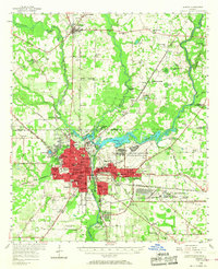
1956 Map of Albany
USGS Topo · Published 1968About this map
The Flint River carves through the heart of this mid-century landscape, anchoring a regional hub where agriculture and the military converged. The burgeoning city of Albany is depicted with a dense network of neighborhoods and education centers like Albany State College and Monroe High Sch. To the northeast, the sprawling Turner Air Force Base and the Naval Marine Corps Supply Center mark a significant defense presence that drove local growth.
Find a feature on this map
107 named features on this map. Tap any name to fly to it.
Don’t see what you’re looking for? This feature index may not catch every label — zoom into the map to look around manually.
Map Details
Editions of this 1956 Albany Map
2 editions found

Other maps of this area

1953 · Dothan
USGS Topo · 1:250,000

1953 · Waycross
USGS Topo · 1:250,000

1954 · Dothan
USGS Topo · 1:250,000

1955 · Dothan
USGS Topo · 1:250,000

1956 · Albany East
USGS Topo · 1:24,000

1956 · Albany West
USGS Topo · 1:24,000

1956 · Baconton
USGS Topo · 1:62,500

1956 · Newton
USGS Topo · 1:62,500

1956 · Sylvester
USGS Topo · 1:62,500

1956 · Sasser
USGS Topo · 1:62,500