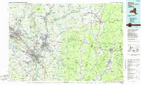
1986 Map of Albany
USGS Topo · Published 1986About this map
The confluence of the Hudson River and Mohawk River anchors this regional perspective of the Capital District and the neighboring mountains of Vermont and Massachusetts in the mid-1980s. The urban corridor stretching from Albany and Troy north to Saratoga Springs reveals a landscape defined by deep industrial roots and political history, centered on the New York State Capitol and the historic Watervliet Arsenal. To the east, the terrain rises sharply into the Taconic Range and the Green Mountains, where the Bennington Battle Monument and Mount Greylock stand as prominent landmarks. This map details the complex transportation network of the era, including the heavy rail lines of the Delaware and Hudson RR and Conrail that follow the river valleys, alongside the expanding interstate system. From the suburban growth in Delmar and Latham to the preserved wilderness of the Green Mountain National Forest, the sheet captures the diverse character of the tri-state border region.
Find a feature on this map
371 named features on this map. Tap any name to fly to it.
Don’t see what you’re looking for? This feature index may not catch every label — zoom into the map to look around manually.
Map Details
Editions of this 1986 Albany Map
This is the sole edition of this map. No revisions or reprints were ever made.
Other maps of this area

1886 · Greylock
USGS Topo · 1:62,500

1886 · Hawley
USGS Topo · 1:62,500

1886 · Chesterfield
USGS Topo · 1:62,500

1886 · Becket
USGS Topo · 1:62,500

1888 · Becket
USGS Topo · 1:62,500

1888 · Berlin
USGS Topo · 1:62,500

1888 · Chesterfield
USGS Topo · 1:62,500

1888 · Pittsfield
USGS Topo · 1:62,500

1889 · Wilmington
USGS Topo · 1:62,500

1890 · Hawley
USGS Topo · 1:62,500