Loading...
Loading map...2022 Map of Alberta
USGS Topo · Published 2022About this map
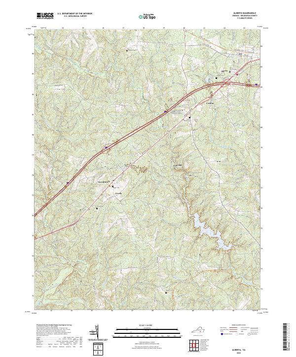
The town of Alberta serves as a central hub in Brunswick County, where the modern corridor of Interstate 85 intersects with older transportation routes like Boydon Plank Rd. This landscape is defined by its transition from a consolidated municipal center to a series of rural hamlets, including Cochran, Meredithville, and Grandy. The southern portion of the area is bounded by the winding course of the Meherrin River and the waters of Totaro Cr.
Find a feature on this map
56 named features on this map. Tap any name to fly to it.
Don’t see what you’re looking for? This feature index may not catch every label — zoom into the map to look around manually.
Map Details
Date Portrayed2022
Date Published2022
PublisherU.S. Geological Survey
Map TypeTopographic
Scale1:24000
Physical Dimensions24 x 29 inches
Editions of this 2022 Alberta Map
This is the sole edition of this map. No revisions or reprints were ever made.
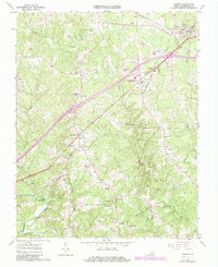
Historical Maps of Meredithville Through Time
Featured Locations
Source Details
SourceU.S. Geological Survey
CopyrightPublic Domain