2022 Map of Aledo
USGS Topo · Published 2022About this map
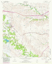
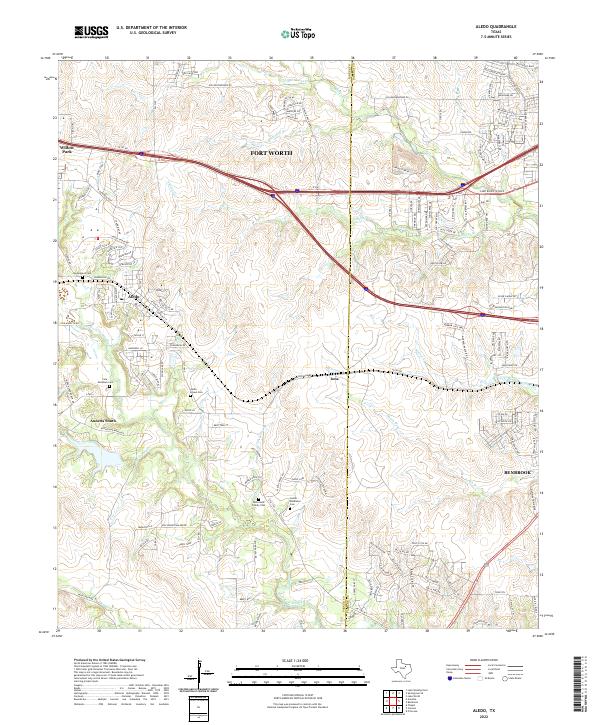
The Clear Fork Trinity River winds through the rolling landscape of eastern Parker County, anchoring a terrain defined by residential expansion and deep-rooted family history. Several burial grounds, including the McConnell Family Cem and the Gomer - Middleton Cem, speak to the legacy of early settlers in the areas surrounding Aledo and Annetta South. These sites provide a direct link to the region's agricultural past, even as modern infrastructure like the W Fwy and the sprawling Walsh Ranch Pkwy development reshape the hills between Willow Park and the western edge of Fort Worth. Numerous tributaries, such as Marys Cr, Walnut Cr, and Dutch Br, carve through the topography, creating the distinct ridges and valleys that have long influenced the placement of original homesteads and modern thoroughfares like Old Weatherford Rd.
Find a feature on this map
143 named features on this map. Tap any name to fly to it.
Don’t see what you’re looking for? This feature index may not catch every label — zoom into the map to look around manually.
Map Details
Editions of this 2022 Aledo Map
This is the sole edition of this map. No revisions or reprints were ever made.