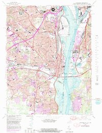
2022 Map of Alexandria
USGS Topo · Published 2022About this map
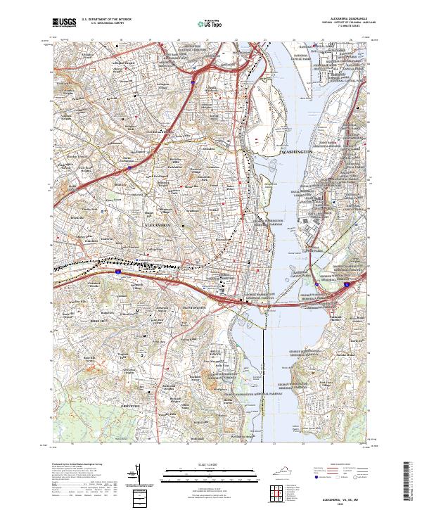
The Pentagon and Arlington National Cemetery anchor the northern reaches of this detailed modern survey of the Potomac River corridor. The map captures the dense urban and suburban layout of Alexandria and Arlington Heights, while preserving the locations of numerous historic burial sites that speak to the area's deep genealogical roots. Small family plots like the Travers Family Graveyard and Deuterman Family Graveyard are recorded alongside larger institutions like the Alexandria National Cemetery. The riverfront is dominated by major infrastructure and military installations, including Ronald Reagan Washington National Airport, the Joint Base Anacostia-Bolling, and the Naval Research Laboratory. This modern perspective allows researchers to trace how contemporary neighborhoods like Del Ray, Rosemont, and Arlandria fit within the complex geography of the nation's capital region.
Find a feature on this map
167 named features on this map. Tap any name to fly to it.
Don’t see what you’re looking for? This feature index may not catch every label — zoom into the map to look around manually.
Map Details
Editions of this 2022 Alexandria Map
This is the sole edition of this map. No revisions or reprints were ever made.
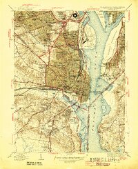
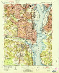
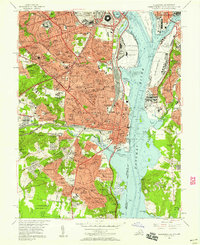
Historical Maps of Washington Through Time
5 maps found