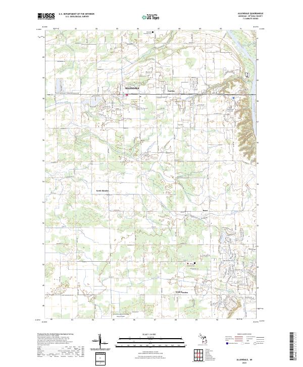
2023 Map of Allendale
USGS Topo · Published 2023About this map
The Grand River forms the eastern boundary of this West Michigan landscape, where the growing campus of Grand Valley State University meets the traditional agricultural and residential patterns of Ottawa County. The township center of Allendale is the primary hub, situated near the intersection of Lake Michigan Dr and several residential corridors. The map reveals a structured grid of rural roads and evolving subdivisions, punctuated by local landmarks like Allendale Township Cem and Pearline.
Find a feature on this map
70 named features on this map. Tap any name to fly to it.
Don’t see what you’re looking for? This feature index may not catch every label — zoom into the map to look around manually.
Map Details
Editions of this 2023 Allendale Map
This is the sole edition of this map. No revisions or reprints were ever made.
Historical Maps of Bauer Through Time
Featured Locations
- Hudsonville, MI
- Tallmadge Charter Township, MI
- Allendale Charter Township, MI
- Blendon Township, MI
- Georgetown Charter Township, MI