2022 Map of Allenton
USGS Topo · Published 2022About this map
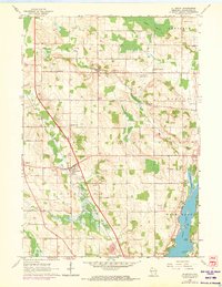
Kohlsville River and the E Br Rock River define the drainage of this Washington County landscape, where small crossroads communities like Kohlsville and Saint Anthony persist amid an organized grid of section lines and rural roads. The area shows a classic upper Midwestern settlement pattern, with localized hamlets such as Allenton and Nabob serving as anchors for the surrounding farmsteads. Genealogical researchers will find several well-defined burial grounds, including the Kewaskum Union Cem and the Albright United Brethren Cem near the town line.
Find a feature on this map
101 named features on this map. Tap any name to fly to it.
Don’t see what you’re looking for? This feature index may not catch every label — zoom into the map to look around manually.
Map Details
Editions of this 2022 Allenton Map
This is the sole edition of this map. No revisions or reprints were ever made.