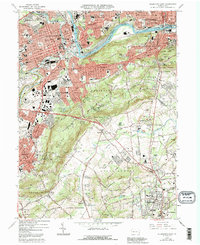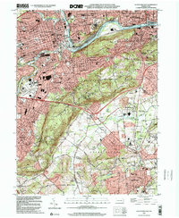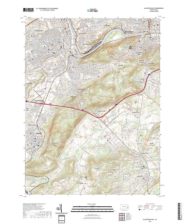
2023 Map of Allentown East
USGS Topo · Published 2023About this map
The Lehigh River carves a distinctive path through this industrial and educational corridor, separating Bethlehem and East Allentown from the rising heights of Lehigh Mountain. The landscape is a dense assembly of historic borough centers and residential enclaves like Fountain Hill and Hanover Acres. A remarkable concentration of burial grounds, including the Emmaus Moravian Cem and Gods Acre Cem, reflects the deep denominational roots of the region's Moravian and Lutheran settlers.
Find a feature on this map
86 named features on this map. Tap any name to fly to it.
Don’t see what you’re looking for? This feature index may not catch every label — zoom into the map to look around manually.
Map Details
Editions of this 2023 Allentown East Map
This is the sole edition of this map. No revisions or reprints were ever made.
Historical Maps of Allentown Through Time
8 maps found