2023 Map of Alloway
USGS Topo · Published 2023About this map
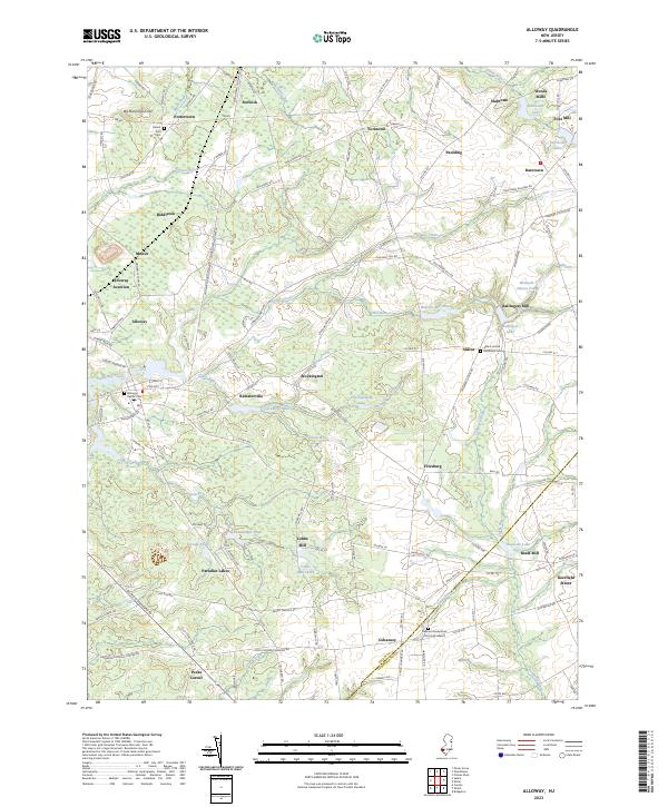
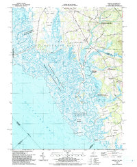
Alloway serves as a central hub in this corner of Salem County, where the landscape is defined by the complex drainage of Alloway Creek and its many tributaries like Cool Run and Deep Run. The map reveals a high density of small, established hamlets and rural industrial sites, particularly old milling centers such as Ballingers Mill, Woods Mills, and Cobbs Mill. This pattern of settlement suggests a long history of water-powered industry along the regional runs and creeks. Moving south toward the boundary with Cumberland County, the terrain transitions into a mosaic of wetlands and ponds, including Thundergut Pond and the Paradise Lakes. Transportation networks, including the W.J. & S.S. R.R. and old routes like Commissioners Pike, link these disparate agricultural and milling communities. Genealogists will find significant value in the documentation of local burial grounds, such as the German Presbyterian Church Graveyard and Mount Zion Cem.
Find a feature on this map
145 named features on this map. Tap any name to fly to it.
Don’t see what you’re looking for? This feature index may not catch every label — zoom into the map to look around manually.
Map Details
Editions of this 2023 Alloway Map
This is the sole edition of this map. No revisions or reprints were ever made.
Historical Maps of Mannington Township Through Time
6 maps found
Featured Locations
- Hopewell Township, NJ
- Mannington Township, NJ
- Quinton Township, NJ
- Upper Pittsgrove Township, NJ
- Alloway Township, NJ