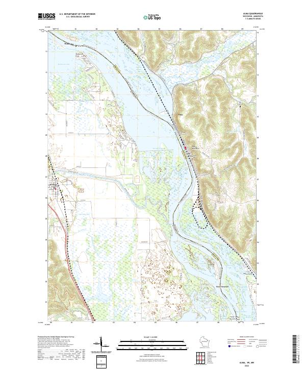
2022 Map of Alma
USGS Topo · Published 2022About this map
The Mississippi River corridor dominates this landscape, serving as the fluid border between Wabasha Co, Minnesota, and Buffalo Co, Wisconsin. The river's intricate network of backwaters includes the winding Wiggle Waggle Slough, Buffalo Slough, and Indian Slough, alongside major tributaries like the Zumbro River and Buffalo River. This 2022 survey documents the topography of the river valley, from the low-lying Second Finger Lake to the significant elevation of Twelve Mile Bluff overlooking the city of Alma. On the Wisconsin side, the Buffalo County Courthouse stands as a central landmark in Alma, while the Minnesota side features the settlements of Wabasha and Kellogg. Genealogists and local historians can locate the Mill Creek Cem and trace the proximity of family lands to historical landmarks like Teepeeota Point and the small community of West Newton near Murphys Cut.
Find a feature on this map
82 named features on this map. Tap any name to fly to it.
Don’t see what you’re looking for? This feature index may not catch every label — zoom into the map to look around manually.
Map Details
Editions of this 2022 Alma Map
This is the sole edition of this map. No revisions or reprints were ever made.
Historical Maps of Kellogg Through Time
4 maps found