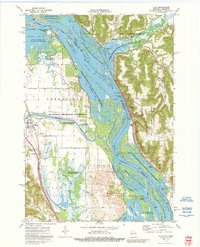
1974 Map of Alma
USGS Topo · Published 1990About this map
Mississippi River navigation and transport dominate this mid-1970s survey of the borderlands between Buffalo and Wabasha counties. The city of Alma is perched on the narrow riverbank beneath high bluffs, defined by the industrial presence of Lock and Dam No 4 and the Burlington Northern rail line. Across the water, the Zumbro River joins the main channel through a network of wetlands and islands protected within the Upper Mississippi River Wild Life and Fish Refuge.
Find a feature on this map
42 named features on this map. Tap any name to fly to it.
Don’t see what you’re looking for? This feature index may not catch every label — zoom into the map to look around manually.
Map Details
Editions of this 1974 Alma Map
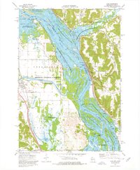
2 editions found
Other maps of this area

1932 · Cochrane
USGS Topo · 1:62,500

1932 · Wabasha
USGS Topo · 1:62,500

1932 · Alma
USGS Topo · 1:62,500

1934 · Plainview
USGS Topo · 1:62,500

1934 · Cochrane
USGS Topo · 1:62,500

1937 · Cochrane
USGS Topo · 1:62,500

1938 · Plainview
USGS Topo · 1:62,500

1950 · Alma
USGS Topo · 1:62,500

1951 · Wabasha
USGS Topo · 1:62,500

1953 · Saint Paul
USGS Topo · 1:250,000