
Loading...
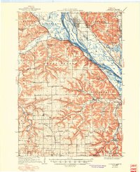
Loading map...1934 Map of Cochrane
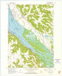
USGS Topo · Published 1968About this map
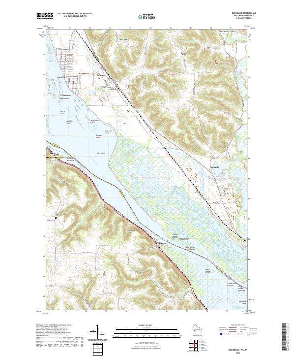
The Mississippi River valley forms a dramatic backdrop for this 1934 survey, where the river's complexity is revealed through named features like Middle Slough, Keller Island, and Sommerfield Island. Along the eastern bluffs, Cochrane and Buffalo City sit near the Chicago Milwaukee St Paul and Pacific railroad, while across the water in Minnesota, the riverfront town of Minneiska serves as a key landmark.
Find a feature on this map
80 named features on this map. Tap any name to fly to it.
Don’t see what you’re looking for? This feature index may not catch every label — zoom into the map to look around manually.
Map Details
Date Portrayed1934
Date Published1968
PublisherU.S. Geological Survey
Map TypeTopographic
Scale1:62,500
Physical Dimensions21.53 x 27.23 inches
Editions of this 1934 Cochrane Map
This is the sole edition of this map. No revisions or reprints were ever made.
Historical Maps of Goodview Through Time
5 maps found

Featured Locations
Source Details
SourceU.S. Geological Survey
CopyrightPublic Domain