
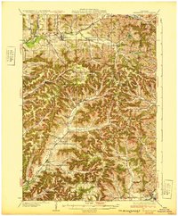
1932 Map of Gilmanton
USGS Topo · Published 1932About this map
The Buffalo River and Elk Creek define the northern valley of this landscape, where the settlement of Gilmanton serves as a local hub. The map reveals a dense network of rural infrastructure, particularly the striking number of neighborhood schools that once served these ridge-and-valley communities. From the Oak Grove Sch in the north to the Schoepp Valley Sch in the south, these institutions appear in nearly every major drainage, reflecting the localized social life of the early 20th century.
Find a feature on this map
99 named features on this map. Tap any name to fly to it.
Don’t see what you’re looking for? This feature index may not catch every label — zoom into the map to look around manually.
Map Details
Editions of this 1932 Gilmanton Map
2 editions found
Other maps of this area

1926 · Whitehall
USGS Topo · 1:62,500

1927 · Strum
USGS Topo · 1:62,500

1929 · Whitehall
USGS Topo · 1:62,500

1929 · Fountain City
USGS Topo · 1:62,500

1929 · Galesville
USGS Topo · 1:62,500

1929 · Durand
USGS Topo · 1:62,500

1930 · Strum
USGS Topo · 1:62,500

1932 · Cochrane
USGS Topo · 1:62,500

1932 · Durand
USGS Topo · 1:62,500

1932 · Alma
USGS Topo · 1:62,500