Old Maps of Trempealeau County, Wisconsin
Explore 162 old maps of Trempealeau County, spanning from 1926 to today. These high-resolution historic maps reveal how streets, neighborhoods, landmarks, and natural features evolved over time — perfect for genealogy, metal detecting, research, and local history exploration.
What you can do with these maps:
- See how Trempealeau County changed over time: Compare historical maps to modern-day views to trace roads, homesites, rail lines & more.
- View detailed metadata: Each map includes creators, publishers, year, scale, and archive source.
- Overlay maps with satellite & LiDAR: Visualize the past alongside modern tools to explore terrain & human change.
- Trusted historical sources: Maps sourced from the USGS, Library of Congress, and other archives.
- Access maps your way: View online, download high-res files, or order prints for personal or research use.
Start exploring old maps of Trempealeau County to uncover forgotten places, hidden landmarks, and the deep history beneath your feet.
Trempealeau County, WI maps
(162)- 1926 Map of North Bend, 1965 Print
 1926 North Bend1965 Print · USGSJackson and La Crosse counties are shown here in the mid-twenties, when the Black River valley was dotted with small family farms and dozens of rural school districts. Genealogists can trace ancestral locations near Stevenstown, Mindoro, and Upper Beaver Creek Ch.
 - 1926 Map of Whitehall, 1972 Print
 1926 Whitehall1972 Print · USGSTrempealeau County is captured here in the mid-twenties, a landscape of coulees and river valleys shaped by the Green Bay and Western Railroad. Genealogists can locate dozens of country schools and homestead-named landmarks like Chimney Rock or the Trempealeau County Asylum.
 - 1927 Map of Blair
 1927 Blair1927 Print · USGSIn the 1920s, the coulee country of Trempealeau and Jackson Counties was a landscape of tightly-knit valley settlements and rural schools. Genealogists can trace family footprints through numerous local landmarks like Schermerhorn School, Pigeon Falls, and Fly Creek School.2 unique versions available
 - 1927 Map of Strum, 1972 Print
 1927 Strum1972 Print · USGSWisconsin's coulee country in the late 1920s is captured here, showing the river-and-rail economies of the Buffalo River valley. Genealogists can locate dozens of country schoolhouses like Hale Corner Sch and family-named landmarks such as Hadleyville Cem.
 - 1929 Map of Whitehall
 1929 Whitehall1929 Print · USGSTrempealeau County during the late twenties is shown here as a dense network of coulees and river-bottom settlements. Researchers can trace early railroad history along the Green Bay and Western RR and locate many rural landmarks including the County Asylum and Brookside Sch.2 unique versions available
 - 1929 Map of Fountain City
 1929 Fountain City1929 Print · USGSIn the late twenties, the Mississippi River bluffs near Fountain City were defined by a steep landscape of narrow valleys and ridge-top farms. Researchers can trace dozens of rural school sites like Buffalo Ridge Sch and Oak Grove Sch among the winding tracks of State Hwy 35.2 unique versions available
 - 1929 Map of Galesville
 1929 Galesville1929 Print · USGSWisconsin's coulee country and the Mississippi riverfront are captured here in the mid-twenties, showing a landscape of bluff-top farms and river towns. Genealogists can locate family landmarks like Butman Corners, Norway Valley Ch, and numerous rural schools including Wayside Sch.2 unique versions available
 - 1929 Map of North Bend
 1929 North Bend1929 Print · USGSWisconsin's coulee country comes alive in this late 1920s survey of the tri-county borderlands along the Black River. Genealogists and local historians can trace family-named landmarks and rural hubs like Beachs Corners, Burr Oak, and the many one-room schoolhouses like Lone Star Sch.2 unique versions available
 - 1930 Map of La Crescent
 1930 La Crescent1930 Print · USGSAs the Mississippi and Black Rivers met in the late twenties, this survey captured a world of river-bottom sloughs and busy rail junctions. Genealogists can trace early homesteads and schools like Oak Grove Sch, while exploring the vanished river paths of Bullet Chute and New Amsterdam.3 unique versions available
 - 1930 Map of Strum
 1930 Strum1930 Print · USGSWestern Wisconsin's river valleys and rail corridors are captured here just before the 1930s. Researchers can trace the lineage of rural townships like Washington and Unity through a network of country schools and churches, including St Paul Ch and Big Creek Sch.2 unique versions available
 - 1932 Map of Gilmanton
 1932 Gilmanton1932 Print · USGSBuffalo and Trempealeau Counties appear here in the early thirties, showing a rural landscape organized around deep valleys and high ridges. Genealogists can locate dozens of family-named landmarks and country schools like Lookout Sch and the Irish Valley Sch.2 unique versions available
 - 1932 Map of Mondovi
 1932 Mondovi1932 Print · USGSThe Buffalo River valley and surrounding coulees are shown here in the early thirties, centered on the hub of Mondovi. Genealogists can locate dozens of country schoolhouses like White Block Sch and rural landmarks such as Norden Ch.2 unique versions available
 - 1934 Map of Winona, 1955 Print
 1934 Winona1955 Print · USGSThe Mississippi River valley in the mid-1930s reveals a complex network of rail lines and river engineering. Researchers can trace the grounds of St Marys College, find rural schools like Meyers Sch, and locate the early infrastructure of Lock and Dam No 5A.2 unique versions available
 - 1935 Map of Osseo
 1935 Osseo1935 Print · USGSOsseo and Augusta were busy railway and river hubs in the mid-1930s, where the rural landscape was tied together by dozens of local schools and the Chicago and Northwestern. Genealogists can trace family footprints at Bear Grass Cem and vanished rural landmarks like Rodell Spur and Troubled Waters Sch.
 - 1937 Map of Winona
 1937 Winona1937 Print · USGSIn the mid-thirties, the Mississippi River valley near Winona was a bustling network of rail yards and river channels. Genealogists and historians can trace the foundations of local communities through landmarks like St Marys College, the St Marys Cem, and vanished schoolhouses like Bohris Valley Sch.3 unique versions available
 - 1940 Map of Osseo
 1940 Osseo1940 Print · USGSOsseo and Augusta anchored this river-carved landscape of west-central Wisconsin in the years surrounding the Great Depression. Researchers can trace the heritage of rural neighborhoods through several dozen district schools, including Troubled Waters Sch, Yule Sch, and Churchview Sch.
 - 1953 Map of Eau Claire, 1965 Print
 1953 Eau Claire1965 Print · USGSWest-central Wisconsin in the mid-fifties shows a landscape of river-valley industry and vast wildlife refuges during the transition from rails to modern highways. Genealogists and historians can trace the rail corridors of the Chicago and North Western or locate family-named landmarks like Decorah Mound and Chippewa Island.4 unique versions available
 - 1956 Map of La Crescent, 1958 Print
 1956 La Crescent1958 Print · USGSThe Mississippi River borderlands thrive in the mid-fifties, showing the transition from the high ridges of Houston and Winona counties to the Wisconsin prairie. Genealogists can trace family names across South Ridge Ch, Loretta Sch, and cemeteries like Crucifixion Cem.2 unique versions available
 - 1958 Map of Eau Claire
 1958 Eau Claire1958 Print · USGSWestern Wisconsin in the late fifties shows a landscape of growing regional hubs and massive wildlife refuges. Trace the rail lines of the Chicago and North Western between Eau Claire and Marshfield, or explore the terrain around Iron Mound and Lake Wissota.
 - 1958 Map of La Crosse, 1979 Print
 1958 La Crosse1979 Print · USGSThe Driftless Area of Wisconsin and Iowa is captured here during the late seventies, showing the intricate river valleys and ridge-top settlements. Genealogists and historians can trace the rail corridors of the Soo Line or locate landmarks like Grandad Bluff and Effigy Mounds National Monument.2 unique versions available
 - 1961 Map of La Crosse
 1961 La Crosse1961 Print · USGSThe Driftless Area at the start of the 1960s reveals a complex network of river towns and rail lines along the Mississippi River. Genealogists and historians can trace old settlements like New Amsterdam and Wyattville or locate major landmarks like Camp McCoy Military Reservation and Effigy Mounds National Monument.
 - 1964 Map of Eau Claire
 1964 Eau Claire1964 Print · USGSWest-central Wisconsin in the mid-1960s was a hub of river-driven industry and expanding rail networks. Researchers can trace historic homesteads near Menomonie, follow the Soo Line RR through Marshfield, or explore the grounds of the Camp McCoy Military Reservation.
 - 1965 Map of La Crosse
 1965 La Crosse1965 Print · USGSThe Driftless Area and the Upper Mississippi valley are captured here during a period of steady mid-century growth. Researchers can trace the rail lines of the Chicago and North Western or locate riverfront sites like Effigy Mounds National Monument and the Camp McCoy Military Reservation.
 - 1968 Map of Blair, 1971 Print
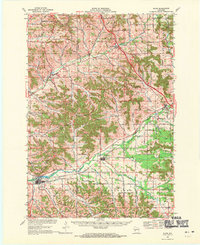 1968 Blair1971 Print · USGSWisconsin's coulee country comes into focus in the late sixties, showing the vital rail-and-river corridor between Blair and Hixton. Researchers can locate the Amish Sch, trace the Green Bay and Western line, and find family names near French Creek Cem.2 unique versions available
 - 1968 Map of Osseo, 1971 Print
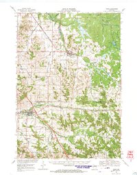 1968 Osseo1971 Print · USGSOsseo and Augusta appear in the late sixties as vital hubs for the Chicago and North Western rail line and regional farming. Researchers can locate historic rural congregations and resting places like St Peters Ch and Thompson Valley Cem amidst a network of small dairy-country valleys.
Showing maps 1-25 of 162
Top cities of Trempealeau County
- Arcadia historical maps
- Osseo historical maps
- Whitehall historical maps
- Trempealeau historical maps
- Independence historical maps
- Galesville historical maps
See more
Frequently asked questions
- What are the different types of historical maps available for Trempealeau County?
- What is the oldest map of Trempealeau County?
- Where can I purchase historical maps of Trempealeau County for my home or office?
- Where can I download high-res historical maps of Trempealeau County?
- Are there historical topographic maps available for Trempealeau County?
- Is there historical aerial imagery available for Trempealeau County?
- Where are historical maps of Trempealeau County sourced from?