
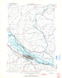
1934 Map of Winona
USGS Topo · Published 1955About this map
The Mississippi River valley forms the centerpiece of this 1930s landscape, where intricate sloughs like Straight Slough and Prairie Slough weave around islands such as Island No 65 and Island No 66. In Winona, the urban grid sits between the river and Lake Winona, serving as a hub for multiple rail lines including the Chicago Milwaukee St Paul and Pacific and the Green Bay and Western. The map reveals a transition in river management with Lock and Dam No 5A near Fountain City, while the surrounding bluffs feature landmarks like Sugarloaf and Garvin Heights State Park. Local life is anchored by institutions like St Marys College and rural centers such as the Buffalo Ridge Sch and Minneowah Club.
Find a feature on this map
93 named features on this map. Tap any name to fly to it.
Don’t see what you’re looking for? This feature index may not catch every label — zoom into the map to look around manually.
Map Details
Editions of this 1934 Winona Map
2 editions found
Other maps of this area

1926 · Whitehall
USGS Topo · 1:62,500

1929 · Whitehall
USGS Topo · 1:62,500

1929 · Fountain City
USGS Topo · 1:62,500

1929 · Galesville
USGS Topo · 1:62,500

1930 · La Crescent
USGS Topo · 1:62,500

1932 · Cochrane
USGS Topo · 1:62,500

1932 · Gilmanton
USGS Topo · 1:62,500

1932 · Alma
USGS Topo · 1:62,500

1934 · Cochrane
USGS Topo · 1:62,500

1937 · Winona
USGS Topo · 1:62,500