2022 Map of Almena
USGS Topo · Published 2022About this map
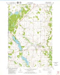
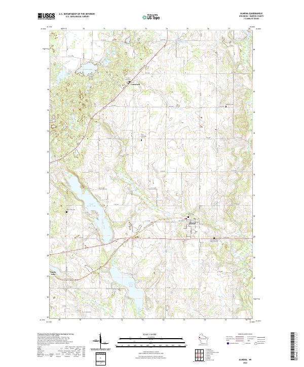
Almena and Comstock anchor this portion of Barron County, where a dense network of country roads connects scattered dairy farmsteads and rural cemeteries. The landscape is defined by its glacial hydrology, featuring significant water bodies such as Upper Turtle Lake, Lower Turtle Lake, and Crystal Lake. The Cattail State Trl follows a linear path across the terrain, tracing an old transportation corridor that once linked these small agricultural communities. This 2022 survey captures the persistent rural character of the region, including local landmarks like the Sacred Heart Cem near Almena and the Zion Lutheran Cem to the north. Smaller drainages including Turtle Creek and Lightning Cr wind through the township boundaries, illustrating the natural drainage patterns that have shaped land use in western Wisconsin for generations.
Find a feature on this map
50 named features on this map. Tap any name to fly to it.
Don’t see what you’re looking for? This feature index may not catch every label — zoom into the map to look around manually.
Map Details
Editions of this 2022 Almena Map
This is the sole edition of this map. No revisions or reprints were ever made.