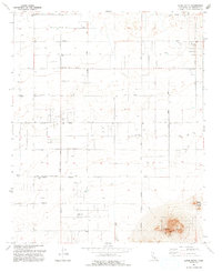
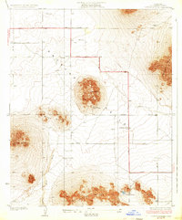
1992 Map of Alpine Butte
USGS Topo · Published 1993About this map
The high desert landscape of the Antelope Valley is dominated by the prominent elevation of Alpine Butte and the adjacent Rocky Buttes, which rise sharply above a grid of surveyed rural sections. In the early 1990s, this area reflects the outward expansion of neighboring desert communities, with the Lancaster Corporate Boundary and Palmdale Corporate Boundary cutting across the sagebrush and scrub. The transition from remote desert to municipal management is evident in the transition from open range to the strictly named grid of thoroughfares like Avenue G and Avenue J. Water management is a central theme of the landscape, marked by numerous water wells and the ephemeral channel of Rock Creek. Landmarks such as the Alpine RS and a Radio Facility denote the technical and navigational utility of these desert heights.
Find a feature on this map
27 named features on this map. Tap any name to fly to it.
Don’t see what you’re looking for? This feature index may not catch every label — zoom into the map to look around manually.
Map Details
Editions of this 1992 Alpine Butte Map
This is the sole edition of this map. No revisions or reprints were ever made.
Other maps of this area

1915 · Elizabeth Lake
USGS Topo · 1:125,000

1917 · Elizabeth Lake
USGS Topo · 1:125,000
1930 · Joshua
USGS Topo · 1:24,000
1930 · Lovejoy Springs
USGS Topo · 1:24,000
1930 · Roosevelt School
USGS Topo · 1:24,000
1930 · Casa Desierta
USGS Topo · 1:24,000
1930 · West Alpine Butte
USGS Topo · 1:24,000
1930 · Tierra Bonita
USGS Topo · 1:24,000
1933 · Casa Desierta
USGS Topo · 1:24,000
1933 · Lovejoy Springs
USGS Topo · 1:24,000