2021 Map of Amador City
USGS Topo · Published 2021About this map
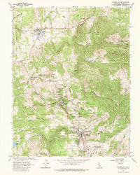
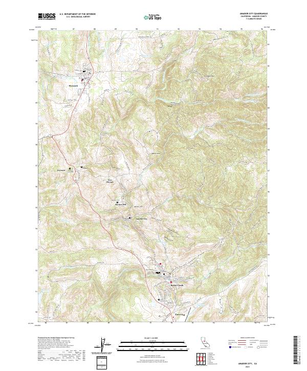
Amador City and the neighboring settlements of Sutter Creek, Drytown, and Plymouth anchor this detailed landscape in Amador County, showing a region defined by its narrow gulches and complex hydraulic history. The terrain is marked by traditional mining-era nomenclature, where drainage features like Whisky Gulch, Gopher Gulch, and Kanaka Gulch descend toward larger watercourses such as Rancheria Cr and Amador Cr. This survey illustrates the intricate network of water management essential to the area's development, featuring the Amador Canal, Ione Canal, and the Plymouth Ditch. For genealogists, the map is particularly valuable for its precise location of numerous historical burial grounds, including the Pioneer Cem, Odd Fellows Cem, and the Immaculate Conception Parish Cem. From the heights of Trembath Mtn to the small community of New Chicago, the map preserves the residential and industrial layout of these Mother Lode towns.
Find a feature on this map
122 named features on this map. Tap any name to fly to it.
Don’t see what you’re looking for? This feature index may not catch every label — zoom into the map to look around manually.
Map Details
Editions of this 2021 Amador City Map
This is the sole edition of this map. No revisions or reprints were ever made.