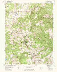
1962 Map of Amador City
USGS Topo · Published 1986About this map
The gold-mining legacy of Amador County is deeply etched into the landscape of this 1962 survey, which covers the historic Mother Lode corridor. Hard-rock mining operations dominate the topography, with major sites like the Empire Mine and Pacific Mine near Plymouth, and the Keystone Mine anchoring Amador City. Further south, the map reveals a dense cluster of industry around Sutter Creek and Sutter Hill, including the Old Eureka Mine and Central Eureka Mine.
Find a feature on this map
67 named features on this map. Tap any name to fly to it.
Don’t see what you’re looking for? This feature index may not catch every label — zoom into the map to look around manually.
Map Details
Editions of this 1962 Amador City Map
4 editions found
Other maps of this area

1889 · Jackson
USGS Topo · 1:125,000

1891 · Placerville
USGS Topo · 1:125,000

1892 · Jackson
USGS Topo · 1:125,000

1892 · Placerville
USGS Topo · 1:125,000

1893 · Placerville
USGS Topo · 1:125,000

1897 · Jackson
USGS Topo · 1:125,000

1902 · Jackson
USGS Topo · 1:125,000

1941 · Sutter Creek
USGS Topo · 1:62,500

1944 · Sutter Creek
USGS Topo · 1:62,500

1947 · Sacramento
USGS Topo · 1:250,000