1947 Map of Sacramento
USGS Topo · Published 1948About this map
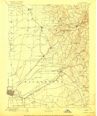
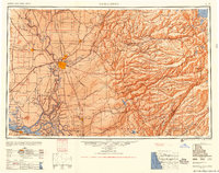
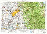
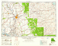
The Sacramento valley floor meets the rising peaks of the Sierra Nevada in this 1947 study, capturing the region's transition from a river-based agricultural hub to a critical military and transportation center. The state capital serves as the primary anchor, flanked by McClellan Air Force Base and Mather Air Force Base, while the intricate waterways of the Sacramento River and San Joaquin River deltas define the southwestern corner. These rivers form a labyrinth of landforms such as Grand Island and Brannan Island, where towns like Rio Vista and Isleton managed the riverine trade. Moving east, the landscape shifts toward the high summits of the Eldorado National Forest, reaching toward Lake Tahoe and the northern reaches of Yosemite National Park. The map documents the extensive rail network including the Southern Pacific RR and Western Pacific RR, which facilitated the growth of foothills settlements like Auburn and Newcastle.
Find a feature on this map
324 named features on this map. Tap any name to fly to it.
Don’t see what you’re looking for? This feature index may not catch every label — zoom into the map to look around manually.
Map Details
Editions of this 1947 Sacramento Map
2 editions found
Historical Maps of Sacramento Through Time
8 maps found