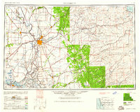
1947 Map of Sacramento
USGS Topo · Published 1961About this map
Sacramento and the surrounding Sacramento Valley are captured here in a period of significant mid-century transition, serving as a vital hub where the Sacramento River meets an extensive rail network. The post-war landscape is defined by the expansion of military aviation at McClellan Air Force Base and Mather Air Force Base, alongside the established academic grounds of the University of California in Davis.
Find a feature on this map
376 named features on this map. Tap any name to fly to it.
Don’t see what you’re looking for? This feature index may not catch every label — zoom into the map to look around manually.
Map Details
Editions of this 1947 Sacramento Map
2 editions found

Other maps of this area

1888 · Marysville
USGS Topo · 1:125,000

1888 · Smartsville
USGS Topo · 1:125,000

1889 · Jackson
USGS Topo · 1:125,000

1889 · Pyramid Peak
USGS Topo · 1:125,000

1889 · Markleeville
USGS Topo · 1:125,000

1891 · Sacramento
USGS Topo · 1:125,000

1891 · Carson
USGS Topo · 1:125,000

1891 · Markleeville
USGS Topo · 1:125,000

1891 · Colfax
USGS Topo · 1:125,000

1891 · Truckee
USGS Topo · 1:125,000