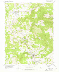
1962 Map of Amador City
USGS Topo · Published 1976About this map
The Mother Lode's hard-rock mining legacy is etched across this landscape, where the concentrated gold-bearing quartz veins of Amador County shaped the growth of several industrial towns. Sutter Creek and Amador City serve as the primary hubs, surrounded by a high density of legendary mining operations including the Keystone Mine, the Old Eureka Mine, and the Bunker Hill Mine. The complex water-management systems required for these operations are evident in the winding path of the Amador Canal and the presence of the Henderson Reservoir.
Find a feature on this map
57 named features on this map. Tap any name to fly to it.
Don’t see what you’re looking for? This feature index may not catch every label — zoom into the map to look around manually.
Map Details
Editions of this 1962 Amador City Map
4 editions found
Other maps of this area

1889 · Jackson
USGS Topo · 1:125,000

1891 · Placerville
USGS Topo · 1:125,000

1892 · Jackson
USGS Topo · 1:125,000

1892 · Placerville
USGS Topo · 1:125,000

1893 · Placerville
USGS Topo · 1:125,000

1897 · Jackson
USGS Topo · 1:125,000

1902 · Jackson
USGS Topo · 1:125,000

1941 · Sutter Creek
USGS Topo · 1:62,500

1944 · Sutter Creek
USGS Topo · 1:62,500

1947 · Sacramento
USGS Topo · 1:250,000