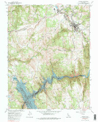
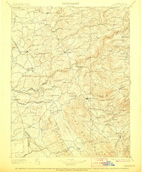
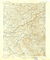
1902 Map of Jackson
USGS Topo · Published 1902About this map
Gold Country mining towns and Sierra foothill topography define this 1888 survey, published shortly after the turn of the century. The Mokelumne River and the Calaveras River cut through the landscape, separated by the prominent Gopher Ridge. This era shows the critical infrastructure of the California Mother Lode, including the Amador Branch Railroad and the San Joaquin and Sierra Nevada Railroad connecting remote camps to the valley. Cultural hubs like San Andreas, Jackson, and Mokelumne Hill are depicted alongside smaller, industrial sites such as the Rich Gulch Mine and several saw mills. The map records a transition from early pioneer camps to established settlements, capturing landmarks like the Fair Grounds at Ione and the isolated Mountain Springs before later regional developments altered these historic corridors.
Find a feature on this map
101 named features on this map. Tap any name to fly to it.
Don’t see what you’re looking for? This feature index may not catch every label — zoom into the map to look around manually.
Map Details
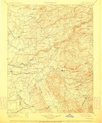
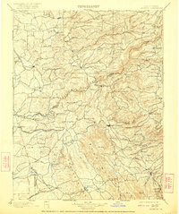
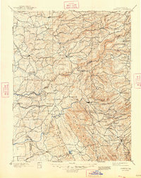
Editions of this 1902 Jackson Map
7 editions found

Historical Maps of Ione Through Time
9 maps found