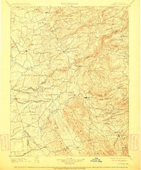
1902 Map of Jackson
USGS Topo · Published 1911About this map
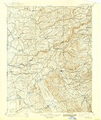
The Mokelumne River carves a deep path through this Gold Country landscape, serving as the historical boundary line between Amador and Calaveras counties. Surveyed in the late 1880s, the map reveals a region defined by its transition from the early mining era to a rail-dependent economy. Hubs like Jackson and Sutter Creek are connected to the wider world via the Amador Branch Railroad, while the San Joaquin and Sierra Nevada Railroad terminates at Valley Springs.
Find a feature on this map
103 named features on this map. Tap any name to fly to it.
Don’t see what you’re looking for? This feature index may not catch every label — zoom into the map to look around manually.
Map Details
Editions of this 1902 Jackson Map
7 editions found

Other maps of this area

1889 · Jackson
USGS Topo · 1:125,000

1889 · Pyramid Peak
USGS Topo · 1:125,000

1891 · Sacramento
USGS Topo · 1:125,000

1891 · Big Trees
USGS Topo · 1:125,000

1891 · Placerville
USGS Topo · 1:125,000

1891 · Pyramid Peak
USGS Topo · 1:125,000

1892 · Jackson
USGS Topo · 1:125,000

1892 · Sacramento
USGS Topo · 1:125,000

1892 · Placerville
USGS Topo · 1:125,000

1893 · Placerville
USGS Topo · 1:125,000