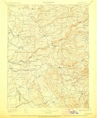
1902 Map of Jackson
USGS Topo · Published 1906About this map
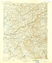
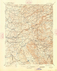
The Mokelumne River carves a deep path through the heart of the Mother Lode on this late nineteenth-century survey, dividing Amador and Calaveras counties. This is a landscape defined by the extraction and transport of wealth, where the Amador Branch Railroad terminates at Ione and the San Joaquin and Sierra Nevada Railroad pushes east toward Valley Springs. The map documents established mining hubs like Mokelumne Hill and San Andreas, alongside smaller, specialized camps such as Rich Gulch Mine and Campo Seco.
Find a feature on this map
116 named features on this map. Tap any name to fly to it.
Don’t see what you’re looking for? This feature index may not catch every label — zoom into the map to look around manually.
Map Details
Editions of this 1902 Jackson Map
7 editions found

Other maps of this area

1889 · Jackson
USGS Topo · 1:125,000

1889 · Pyramid Peak
USGS Topo · 1:125,000

1891 · Sacramento
USGS Topo · 1:125,000

1891 · Big Trees
USGS Topo · 1:125,000

1891 · Placerville
USGS Topo · 1:125,000

1891 · Pyramid Peak
USGS Topo · 1:125,000

1892 · Jackson
USGS Topo · 1:125,000

1892 · Sacramento
USGS Topo · 1:125,000

1892 · Placerville
USGS Topo · 1:125,000

1893 · Placerville
USGS Topo · 1:125,000