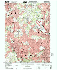
1999 Map of Ambler
USGS Topo · Published 2001About this map
Willow Grove Naval Air Station Joint Reserve Base dominates the eastern landscape of this late-twentieth-century study of Montgomery County. The map documents a densely developed suburban corridor where established boroughs like Ambler and Fort Washington are interconnected by the Septa rail lines and the Pennsylvania Turnpike. This era shows the mature integration of educational and historical sites into the community fabric, featuring the Temple University (Ambler Campus), Gwynedd-Mercy College, and the preserved Graeme Historical Site.
Find a feature on this map
82 named features on this map. Tap any name to fly to it.
Don’t see what you’re looking for? This feature index may not catch every label — zoom into the map to look around manually.
Map Details
Editions of this 1999 Ambler Map
This is the sole edition of this map. No revisions or reprints were ever made.
Other maps of this area

1888 · Quakertown
USGS Topo · 1:62,500

1890 · Doylestown
USGS Topo · 1:62,500

1890 · Quakertown
USGS Topo · 1:62,500

1891 · Doylestown
USGS Topo · 1:62,500

1893 · Germantown
USGS Topo · 1:62,500

1894 · Quakertown
USGS Topo · 1:62,500

1894 · Norristown
USGS Topo · 1:62,500

1894 · Germantown
USGS Topo · 1:62,500

1895 · Norristown
USGS Topo · 1:62,500

1896 · Germantown
USGS Topo · 1:62,500
Featured Places
- Abington Township, PA
- Warminster Township, PA
- Horsham Township, PA
- Warrington Township, PA
- Whitemarsh Township, PA