2023 Map of Amboy
USGS Topo · Published 2023About this map
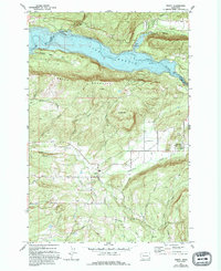
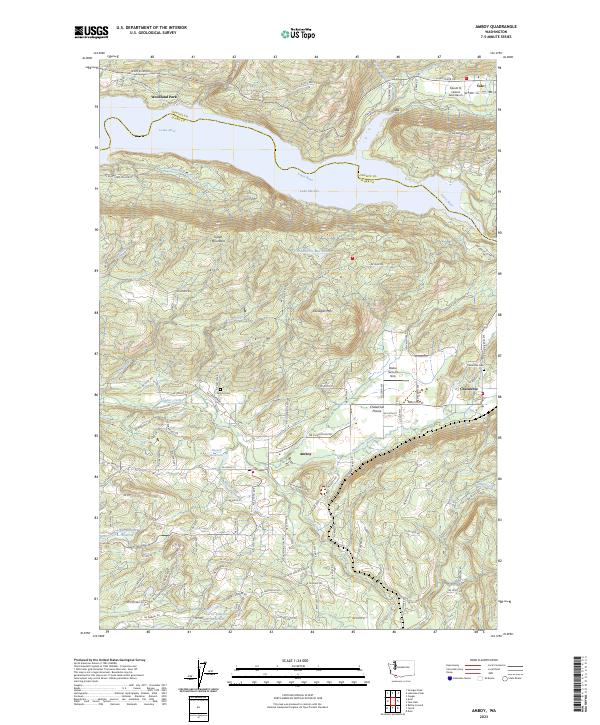
Lake Merwin dominates the northern reaches of this Clark County landscape, where the Lewis River forms the boundary with Cowlitz County. The map documents a rural transition between timbered uplands and developed valley floors, particularly evident around the Chelatchie Prairie and the community of Amboy. The presence of the Columbia Tie Mill Pond reflects the area's industrial legacy, while aviation markers like Walter Sutton's Strip and the Mount St Helen's Aero Ranch point to modern land use. Local history is anchored by the Amboy Cem and Chelatchie Cem, alongside several smaller water bodies including Fassett Reservoir and Warren Speely Reservoir. Significant topographic features such as Green Mountain and Dunegan Mtn rise above the many creek branches, including Chelatchie Creek and Cedar Creek, that drain these foothills.
Find a feature on this map
110 named features on this map. Tap any name to fly to it.
Don’t see what you’re looking for? This feature index may not catch every label — zoom into the map to look around manually.
Map Details
Editions of this 2023 Amboy Map
This is the sole edition of this map. No revisions or reprints were ever made.