2021 Map of Anderson
USGS Topo · Published 2021About this map
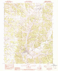
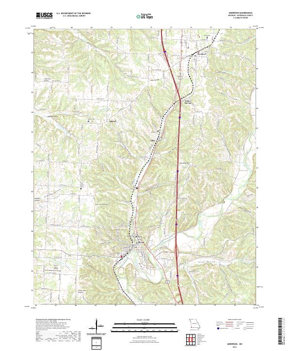
Indian Creek winds through the heart of this McDonald County landscape, carving a path between the established settlements of Anderson and Goodman. The terrain is defined by an intricate network of hollows, such as Bunkum Hollow, Slover Hollow, and Thief Hollow, which historically dictated the movement of residents and the placement of small communities like Splitlog and Elliff. This 2021 study captures the modern infrastructure of U.S. Route 71 and Interstate 49 as they cut through the Ozark topography, contrasting with the quiet rural character of family-named landmarks and local burial grounds including Anderson Cem and Peace Valley Cem. Researchers can trace the drainage patterns of N Fork Beeman Br and S Fork Patterson Cr alongside contemporary features like the B and S Farms Airfield, reflecting a region where deep-rooted agricultural life persists alongside major transit corridors.
Find a feature on this map
81 named features on this map. Tap any name to fly to it.
Don’t see what you’re looking for? This feature index may not catch every label — zoom into the map to look around manually.
Map Details
Editions of this 2021 Anderson Map
This is the sole edition of this map. No revisions or reprints were ever made.