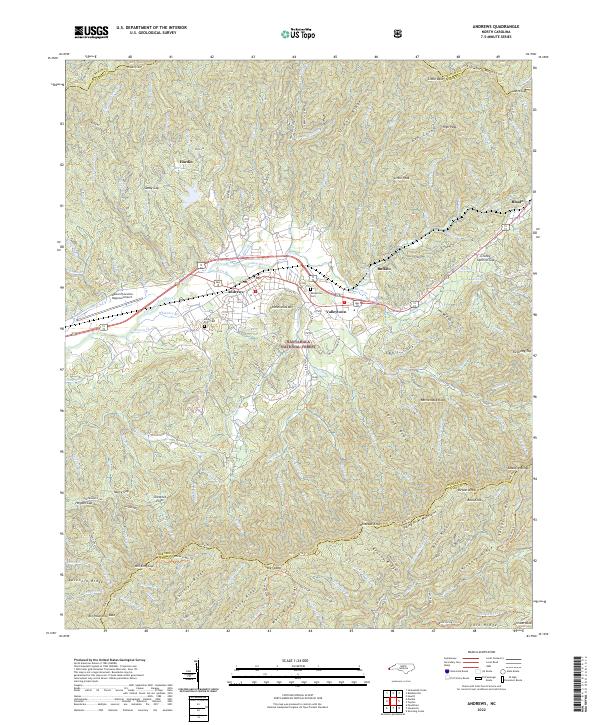
2022 Map of Andrews
USGS Topo · Published 2022About this map
Andrews serves as the central hub of this mountain valley, where the Valley River snakes through a landscape defined by the towering Snowbird Mountains to the north and the Valley River Mountains to the south. Large portions of the terrain are protected within the Nantahala National Forest, marked by numerous gaps and peaks like Sandy Gap and High Peak. The settlement pattern follows the river corridor and the path of Bus 19, connecting smaller communities such as Valleytown and Buffalo.
Find a feature on this map
126 named features on this map. Tap any name to fly to it.
Don’t see what you’re looking for? This feature index may not catch every label — zoom into the map to look around manually.
Map Details
Editions of this 2022 Andrews Map
This is the sole edition of this map. No revisions or reprints were ever made.
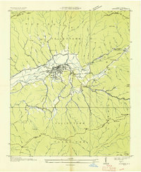
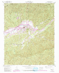
Historical Maps of Valleytown Through Time
3 maps found