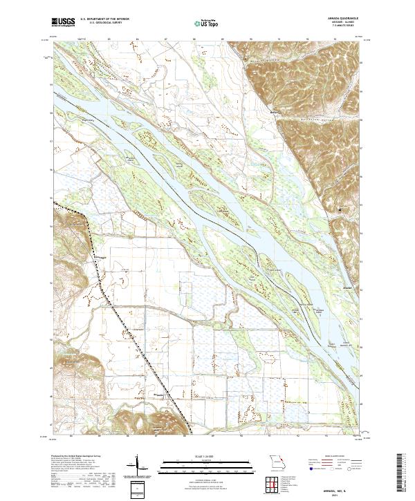
2021 Map of Annada
USGS Topo · Published 2021About this map
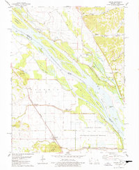
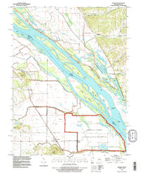
Annada sits at the foot of Saltpeter Bluff in this riverfront landscape along the border of Pike County, Missouri, and Calhoun County, Illinois. The Mississippi River dominates the geography, weaving between large landmasses such as Eagle Island, Amaranth Island, and Coon Island. The floodplain is intricate, marked by secondary water channels like Shafer Slough, Negro Slough, and Slim Chute. To the east, the terrain rises sharply into the Illinois bluffs, where named hollows including Wildcat Hollow and Infidel Hollow cut into the upland forest. Small settlements and points of interest for local history are scattered throughout, from Belleview and Kissenger to family landmarks like Cooper Knobs. The map also identifies quiet rural burial sites, including Long Cem and Poor Cem, offering a detailed view of the regional land use before the modern era.
Find a feature on this map
61 named features on this map. Tap any name to fly to it.
Don’t see what you’re looking for? This feature index may not catch every label — zoom into the map to look around manually.
Map Details
Editions of this 2021 Annada Map
This is the sole edition of this map. No revisions or reprints were ever made.