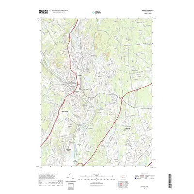
2021 Map of Ansonia
USGS Topo · Published 2021About this map
The confluence of the Housatonic River and the Naugatuck River serves as the geographic anchor for this detailed mapping of industrial and residential growth in the Naugatuck Valley. The settlements of Ansonia, Derby, and Shelton dominate the riverbanks, showing a dense network of streets and neighborhoods that climb the surrounding hills. Several major burial grounds, including Mount Saint Peters Cem and the Beth Israel Cem of Congregation Or Shalom, are situated near the waterways, providing essential records for genealogists. The influence of the Metro-North Railroad remains evident, tracing the river valley's floor through the heart of the urban centers. Away from the riverside hubs, the landscape transitions into the wooded slopes of Turkey Hill and Baldwin Hill, where local water resources like the Quillinan Reservoir and Wepawaug Reservoir support the region's infrastructure.
Find a feature on this map
378 named features on this map. Tap any name to fly to it.
Don’t see what you’re looking for? This feature index may not catch every label — zoom into the map to look around manually.
Map Details
Editions of this 2021 Ansonia Map
This is the sole edition of this map. No revisions or reprints were ever made.
Other maps of this area

1889 · Derby
USGS Topo · 1:62,500

1891 · Bridgeport
USGS Topo · 1:62,500

1891 · Derby
USGS Topo · 1:62,500

1892 · New Haven
USGS Topo · 1:62,500

1893 · Bridgeport
USGS Topo · 1:62,500

1893 · Derby
USGS Topo · 1:62,500

1920 · Bridgeport
USGS Topo · 1:62,500

1921 · New Haven
USGS Topo · 1:62,500

1943 · New Haven
USGS Topo · 1:31,680

1943 · Naugatuck
USGS Topo · 1:31,680