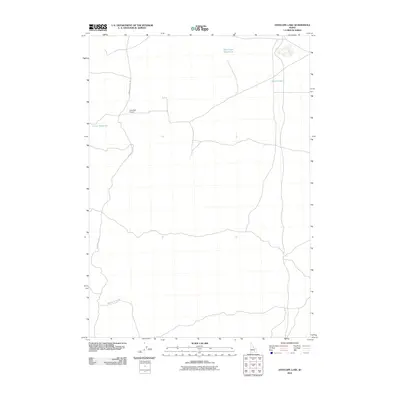
2010 Map of Antelope Lake
USGS Topo · Published 2010About this map
The Minidoka To Arco Rd winds through this arid section of Blaine County, serving as a primary transit corridor across a landscape defined by water management and isolated infrastructure. Grounded in a region where every water source is critical, the map identifies small-scale hydrological features such as Martin Lake, Corner Reservoir, and the descriptively named Road Lake Waterhole. Aviation history and utility are represented by the presence of Coxs Well Airport, a remote landing strip located just off the main road. The settlement pattern here is sparse, characterized by the intersection of high-desert transportation routes and the essential wells and reservoirs that supported early 21st-century ranching and travel in the Idaho interior.
Find a feature on this map
5 named features on this map. Tap any name to fly to it.
Don’t see what you’re looking for? This feature index may not catch every label — zoom into the map to look around manually.
Map Details
Editions of this 2010 Antelope Lake Map
This is the sole edition of this map. No revisions or reprints were ever made.
Other maps of this area

1955 · Idaho Falls
USGS Topo · 1:250,000

1958 · Idaho Falls
USGS Topo · 1:250,000

1972 · Antelope Lake
USGS Topo · 1:24,000

1972 · Split Top
USGS Topo · 1:24,000

1972 · Mule Butte
USGS Topo · 1:24,000

1972 · Pratt Butte
USGS Topo · 1:24,000

1972 · Mosby Well
USGS Topo · 1:24,000

1972 · Mosby Butte
USGS Topo · 1:24,000

1972 · Bear Park East
USGS Topo · 1:24,000

1972 · Sunset Lake
USGS Topo · 1:24,000